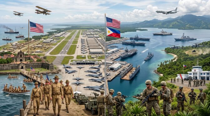
1. Executive Summary
The historical trajectory of United States military installations within the Philippine archipelago constitutes a complex narrative of American global force projection, colonial administration, and mutual defense strategy. Commencing with the conclusion of the Spanish-American War and the subsequent Treaty of Paris in 1898, the United States acquired the Philippines and occupied existing Spanish military infrastructure.1 Over the ensuing decades, this early footprint evolved into a sophisticated network of naval, army, and aviation facilities. These installations—most notably the logistical and power-projection hubs of Clark Air Base and Naval Base Subic Bay—served as the cornerstone of American military deterrence and operational staging in the Pacific Theater.3 They were utilized during the pacification campaigns of the early 20th century, the crucible of World War II, and the subsequent containment strategies of the Cold War, including the Korean and Vietnam conflicts,.32
However, the enduring presence of these sovereign-style American bases generated diplomatic, social, and political friction. From the perspective of the United States, the bases were strategic nodes required for regional stability and global military readiness.3 Conversely, to a newly independent Philippine republic post-1946, these military reservations frequently represented a visible truncation of national sovereignty and a vestige of colonial subjugation.4 Decades of intensive diplomatic renegotiations progressively reduced the physical footprint, lease durations, and jurisdictional autonomy of these facilities.1 This diplomatic struggle culminated in the historic September 1991 Philippine Senate vote to reject the extension of the Military Bases Agreement, an act that forced a total American military withdrawal by 1992.1
Following the withdrawal, the physical infrastructure of these former bases was systematically assimilated by the Armed Forces of the Philippines (AFP) and various civilian economic zones. Military reservations were converted into commercial international airports, maritime freeport zones, and metropolitan centers.5 Today, the bilateral defense relationship has pivoted away from the permanent, sovereign-style American basing model toward a strategy of reciprocal rotational access. Driven by shifting geopolitical dynamics and maritime security challenges in the South China Sea, the 2014 Enhanced Defense Cooperation Agreement (EDCA) and its 2023 expansion have granted United States forces rotational access to nine strategic AFP installations.1 This report details the history, operational significance, nomenclature evolution, armament specifics, and current status of major United States military installations in the Philippines.
2. Strategic Geopolitics and the Legal Architecture of American Basing
The legal and geopolitical framework governing the presence of United States military forces in the Philippines has undergone structural changes over the last century. This evolution reflects the maturation of the Philippine state, the changing threat landscape of the Pacific, and the shifting dynamics of the bilateral alliance.
The initial phase of American military basing was rooted in territorial acquisition. Following the Spanish-American War, the United States assumed control of the archipelago under the terms of the 1898 Treaty of Paris.7 The U.S. military occupied former Spanish arsenals and established new reservations under executive orders signed by presidents such as Theodore Roosevelt.8 During this colonial and Commonwealth era (1898–1946), the United States exercised territorial sovereignty over tracts of land, establishing cavalry posts, coastal artillery batteries, and aviation fields to secure the archipelago against internal insurrection and external imperial threats.9
The devastation of World War II and the subsequent recognition of Philippine independence on July 4, 1946, altered this dynamic. The two nations sought to formalize their post-independence security arrangement. In 1944, anticipating the post-war strategic landscape, the U.S. Congress authorized the acquisition of bases for mutual protection.1 This legislative authorization led directly to the Military Bases Agreement (MBA), signed on March 14, 1947.4 The 1947 MBA was a sweeping document that granted the United States the right to retain the use of 16 specific bases—including complexes at Clark Field and Subic Bay—for a term of 99 years.1 The agreement also granted the U.S. military the right to access several additional bases, such as those in Palawan and the Sulu Archipelago, should military necessity dictate.1
Despite the mutual defense imperative, the terms of the 1947 MBA quickly became a source of friction. By the mid-1950s, the administration of the bases became a contentious issue in bilateral relations.3 American authorities claimed legal title over large tracts of land and exercised extraterritorial jurisdiction over Filipino civilians within and adjacent to the bases.3 These jurisdictional disputes provided ammunition for Philippine nationalists who argued that independence remained incomplete as long as American military police could exercise authority over Philippine citizens on Philippine soil.4 Over time, the U.S. presence was progressively scaled back. In 1958, the United States officially relinquished the Manila Military Port area, ending its military installation presence within the capital city proper.1
In response to domestic tensions, the 1966 Rusk-Ramos Agreement significantly altered the structural arrangement of the alliance.1 The agreement shortened the base leaseholds from 99 years to 25 years, moving the expiration date to 1991.1 It also officially terminated U.S. civil control over adjacent civilian municipalities, such as Olongapo, and limited U.S. military holdings to a few major bases.1 A subsequent 1979 amendment further eroded the sovereign-style nature of the bases by mandating the installation of Philippine commanders at each facility and introducing a formal financial compensation model, though the United States retained operational command over its specific facilities.1
The expiration of the 1947 MBA leasehold fell in 1991, coinciding with the end of the Cold War and the eruption of Mount Pinatubo, which rendered Clark Air Base operationally unviable.1 Against this backdrop, the Philippine Senate engaged in a debate over the proposed Treaty of Friendship, Peace and Cooperation, which would have extended the lease of Subic Bay for an additional ten years. On September 16, 1991, the Philippine Senate narrowly rejected the treaty by a 12–11 vote, viewing the bases as lingering remnants of colonialism.1 This compelled the deactivation of U.S. permanent bases and a military withdrawal by 1992.1
For two decades following the withdrawal, the U.S. military presence in the Philippines was limited to temporary, joint training exercises governed by the 1999 Visiting Forces Agreement (VFA).1 However, territorial disputes in the West Philippine Sea prompted a strategic recalibration in Manila and Washington.11 In 2014, the two nations signed the Enhanced Defense Cooperation Agreement (EDCA).1 Unlike the 1947 MBA, EDCA respects Philippine sovereignty by granting U.S. forces only rotational access to designated, Philippine-owned and Philippine-commanded military facilities.1 Originally covering five locations, EDCA was expanded in 2023 to include four additional sites positioned to address modern maritime security challenges.6
3. The Manila Bay and Cavite Complexes: The Early Naval Footprint
The earliest iteration of American military basing in the Philippines was concentrated around Manila Bay, capitalizing on centuries of Spanish maritime engineering. Following the naval engagement of the Battle of Manila Bay on May 1, 1898, Commodore George Dewey and the Asiatic Squadron defeated the Spanish fleet. By the morning of May 2, Dewey took formal possession of the Spanish arsenal and shipyard situated on the eastern end of the bay at Cavite.12
3.1 Cavite Navy Yard
The Cavite Navy Yard possessed a military history long before the arrival of American forces. The Spanish had occupied the strategic peninsula since the 16th century, building arsenals and defensive forts to protect the capital city of Manila from seaborne attack.12 In the 19th century, the Spanish added dedicated shipbuilding facilities and a makeshift medical installation at nearby Sangley Point. Prior to the U.S. Navy’s arrival, the shipyard served as the command center for all Spanish naval operations and was the principal naval station in the Philippines.12
Upon taking control, the U.S. Navy found the Spanish shipbuilding and repair facilities to be outdated. The Navy embarked on a modernization program to upgrade the yard to service modern warships.12 Cavite Navy Yard became the chief repair and refueling base for the entire U.S. Asiatic Fleet, with the fleet’s headquarters established nearby on the Manila waterfront.12 The facility also served an infantry role; on April 13, 1899, following the outbreak of the Philippine-American War, a battalion of U.S. Marines arrived to protect the Navy Yard from Filipino insurgents.12 Subsequent Marine deployments to Cavite over the next two years formed the nucleus of the 1st Marine Regiment. The Cavite Navy Yard operated under American control through World War II, finally closing in 1948 as the Navy shifted its primary focus to the deeper waters of Subic Bay.12
3.2 U.S. Naval Station Sangley Point
While the Cavite Navy Yard closed shortly after World War II, the adjacent U.S. Naval Station Sangley Point remained an active facility for the United States Navy throughout the early Cold War.12 Located on a peninsula jutting into Manila Bay, Sangley Point housed a Naval Air Station and the expanded Naval Hospital Cañacao.3 It served as a communications and logistics relay for fleet operations in the South China Sea. However, as the U.S. footprint was gradually reduced, Sangley Point was deactivated by the U.S. Navy in 1971.1 Following its transfer to the Republic of the Philippines, the peninsula was divided between the nation’s maritime and aviation branches. Today, it operates as Naval Base Heracleo Alano for the Philippine Navy and Major Danilo Atienza Air Base for the Philippine Air Force.
3.3 Naval Base Manila
In addition to the Cavite facilities, the United States maintained Naval Base Manila, a support base situated directly south of the city of Manila.7 Recognizing the growing threat from the Empire of Japan, the U.S. Navy began utilizing civilian contractors in 1938 to construct new waterfront facilities in Manila.7 As the headquarters for the short-lived American-British-Dutch-Australian Command (ABDACOM), Manila was briefly the focal point of Allied defense efforts. However, lacking sufficient troops and air cover to halt the Japanese advance, construction was halted on December 23, 1941.7 Manila was declared an open city, and the base was abandoned to the Japanese in January 1942, with remaining naval personnel retreating to Bataan.7 Following the war, the U.S. maintained a military port unloading facility in Manila harbor to primarily serve logistics trains heading north to Clark Field.3 In 1958, this Manila Military Port area was formally relinquished, marking the end of American military installations within the capital city limits.1
4. The Harbor Defenses of Manila and Subic Bays: The Island Fortresses
To secure the maritime approaches to Manila and Subic Bay, the United States Army Coast Artillery Corps embarked on an ambitious military engineering project.8 Authorized by President Theodore Roosevelt in 1902, the military constructed a network of armed island fortresses known collectively as the Harbor Defenses of Manila and Subic Bays.13 By July 1941, this command was led by Major General George F. Moore and comprised nearly 5,000 assigned troops operating vast arrays of coastal artillery.8 These fortresses were subjected to Japanese aerial and artillery bombardment in 1942, eventually surrendering in May of that year.14 Today, they stand as historical monuments, reclaimed by nature or repurposed by the modern Philippine military.
4.1 Fort Mills (Corregidor Island)
Corregidor Island, a tadpole-shaped landmass located directly at the mouth of Manila Bay, was the largest and most fortified of the harbor defenses.8 Named Fort Mills, the island was divided by topography into specific military zones: Topside, Middleside, and Bottomside.15 Topside, a wide plateau, contained the majority of Fort Mills’ coastal artillery pieces and reinforced concrete installations. Middleside housed additional battery positions and barracks complexes, while Bottomside contained the primary dock area and the civilian town of San Jose.15 To the east lay the narrow tail of the island, which featured an aviation landing strip known as Kindley Field.15 The island was famous for the Malinta Tunnel, a subterranean complex bored through solid rock that contained the command headquarters, a lateral hospital, and communication arrays safe from aerial bombardment.15 Today, Corregidor Island is a protected Philippine National Monument and a destination for historical tourism.16
4.2 Fort Drum (El Fraile Island)
Fort Drum, located on El Fraile Island, was a highly engineered military installation in the Pacific.8 Completed in 1914, the U.S. Army leveled the rocky island down to the water line and encased it in thick, reinforced concrete, shaping the island to resemble the hull of a battleship.15 This “concrete battleship” was armed with a main battery of four 14-inch guns mounted in two armored steel turrets (Batteries Wilson and Marshall), supplemented by 6-inch guns mounted in casemates along the hull.16 During the Japanese invasion, Fort Drum’s durable construction allowed it to survive intense onslaughts, surrendering only when ammunition and supplies were exhausted on May 6, 1942.14 Today, the abandoned fort remains an informal memorial to its defenders, serving a practical modern role as a navigational light site operated by the Philippine Coast Guard.14
4.3 Fort Hughes (Caballo Island)
Situated near Corregidor, Fort Hughes was constructed on Caballo Island, a rocky bluff that divides the entrance to Manila Bay into the North and South Channels.13 Construction was largely completed by 1914, with the installation of its primary armament: 14-inch M1910 guns mounted on disappearing carriages (Batteries Gillespie and Woodruff).17 In 1919, the fort’s firepower was upgraded with the completion of Battery Craighill, which featured four 12-inch mortars.17 Unlike Corregidor, Caballo Island is currently an active military installation occupied by the Philippine Navy and is strictly off-limits to civilians.13 The island’s isolated geography made it a location for the AFP to utilize as a secure quarantine facility in November 2014 for Filipino peacekeepers returning from Ebola-stricken West Africa.13
4.4 Fort Frank (Carabao Island)
Located on Carabao Island, Fort Frank was the most vulnerable of the Manila Bay fortresses. Situated a mere 500 yards from the Cavite shoreline, it was susceptible to land-based artillery attacks from the mainland.15 The fort was armed with 14-inch guns on disappearing carriages (Batteries Greer and Crofton) and eight 12-inch mortars (Battery Koehler).13 During the siege of 1942, its proximity to the Japanese-occupied mainland allowed enemy artillery to systematically diminish the American and Filipino defensive responses.14 Fort Frank surrendered alongside its counterparts on May 6, 1942.14 Today, the island is abandoned. Its concrete structures and remaining armaments have been largely inundated and consumed by tropical vegetation, accessible only via private boats.14
4.5 Fort Wint (Grande Island)
To protect the deep-water anchorage of Subic Bay, the U.S. Army fortified Grande Island, designating it Fort Wint.8 The fort was armed primarily with 10-inch guns mounted on disappearing carriages.16 While it did not see the same level of siege warfare as the Manila Bay forts due to the rapid tactical withdrawal of forces toward Bataan in late 1941, it remained a component of the coastal defense strategy. Fort Wint was eventually turned over to the Philippine government in 1992 alongside the rest of the Subic Bay Naval Base.16 Today, Grande Island is utilized as a radar site and has been partially developed into a resort area.16
4.6 Armament Summary of the Island Fortresses
The scale of the coastal artillery deployed to protect the Philippine harbors represented a large logistical and engineering effort. Table 1 details the primary heavy armament of the island fortresses prior to the outbreak of World War II.
Table 1: Primary Heavy Armament of the Island Fortresses
| Fort Installation | Island Location | Primary Heavy Armament Batteries | Carriage / Mounting Type | Year Operational |
| Fort Mills | Corregidor | Batteries Hearn, Smith, Way, Geary, Cheney, Wheeler, Crockett | 12-inch Guns, 12-inch Mortars | 1910-1921 |
| Fort Drum | El Fraile | Batteries Wilson, Marshall | 14-inch Guns in Steel Turrets | 1918 |
| Fort Hughes | Caballo | Batteries Gillespie, Woodruff, Craighill | 14-inch Disappearing, 12-inch Mortars | 1914-1919 |
| Fort Frank | Carabao | Batteries Greer, Crofton, Koehler | 14-inch Disappearing, 12-inch Mortars | 1913 |
| Fort Wint | Grande Island | Battery Warwick | 10-inch Disappearing | 1910 |
5. Early Army and Aviation Installations: Central Luzon and Metro Manila
Beyond the fortified coastal and naval facilities, the United States established several Army and Air Corps installations in the early 1900s to facilitate the administration, training, and aerial defense of the archipelago. As the Philippines gained independence, these bases were among the first to be transferred to the Philippine government, evolving into the core command centers of the modern Armed Forces of the Philippines or transitioning into commercial real estate.
5.1 Fort William McKinley (Metro Manila)
Established in 1901 during the Philippine-American War, Fort William McKinley was created when the U.S. government declared a 25.78-square-kilometer property south of the Pasig River in Taguig as a U.S. Military Reservation.19 Named after the 25th President of the United States, Fort McKinley became an administrative and training hub.19 Prior to World War II, it served as the headquarters for both the Philippine Department and the Philippine Division of the United States Army Forces in the Far East (USAFFE).19 It was the primary location for specialized artillery training and the home of the 31st Infantry Regiment.19
Following Philippine independence, the United States surrendered its rights of possession and jurisdiction over the facility, formally turning it over to the Philippine government on May 14, 1949.20 Under the leadership of AFP General Alfonso Arellano, the base was made the permanent headquarters of the Philippine Army in 1957.19 It was subsequently renamed Fort Andres Bonifacio, honoring the recognized Father of the Philippine Revolution against Spain.20 While the AFP retains its core headquarters in the area, massive tracts of the former military reservation were later privatized by the government’s Bases Conversion and Development Authority (BCDA).21 Today, that land has been transformed into Bonifacio Global City (BGC), one of Metro Manila’s financial, commercial, and residential districts.19 The solemn Manila American Cemetery and Memorial, established after World War II, remains preserved on a portion of the original site.22
5.2 Camp Nichols (Pasay/Parañaque)
Camp Nichols was established in 1919 by the Air Service of the United States Army.23 Located just south of Manila near Fort McKinley, it served as the original home of the 1st Group (Observation) and subsequently became the headquarters of the Philippine Department Air Force.23 During the outbreak of World War II, the airfield was captured by advancing Japanese forces and utilized by the Imperial Japanese Navy Air Service.23 The occupying forces used Camp Nichols as a prisoner-of-war labor camp, forcing captives to expand the airfield’s runways.24
After the liberation of Manila, U.S. and Philippine forces used the repaired airfield as a launch pad for combat operations.24 Following the war, Nichols Airfield was turned over to the Philippine government and officially renamed Colonel Jesus Villamor Air Base.24 The name honors a decorated Filipino-American fighter pilot and clandestine intelligence agent who exhibited valor fighting the Japanese.25 Today, Villamor Air Base serves as the general headquarters for the Philippine Air Force, located in Pasay City, Metro Manila, and uniquely shares its extensive runway infrastructure with the bustling Ninoy Aquino International Airport (NAIA).23
5.3 Camp Murphy and Zablan Field (Quezon City)
Opened in 1935, Camp Murphy was an American-era military base named after William Francis Brennan Murphy, the former American Governor-General and High Commissioner to the Philippines.27 On December 23, 1935, the site became the designated headquarters for the newly formed Philippine Army Air Corps (PAAC).28 The camp featured Zablan Field, an aviation facility characterized by intersecting sod runways.28 Zablan Field holds a unique place in history as the location where Major Dwight D. Eisenhower—then serving as the assistant to Military Advisor General Douglas MacArthur—took his early flying lessons.28
As Japanese aggression loomed over Southeast Asia in 1941, Camp Murphy and Zablan Airfield were urgently transferred to the U.S. Far East Air Force (FEAF) on August 15, 1941.28 The base suffered significant damage during a Japanese air raid on December 10, 1941.28 Decades after its return to Philippine control, the Philippine Congress passed Republic Act No. 4434 in 1965, officially changing the name of Camp Murphy to Camp General Emilio Aguinaldo.29 Today, Camp Aguinaldo is the site of the General Headquarters (GHQ) of the Armed Forces of the Philippines, located in Quezon City, Metro Manila 30, while an adjacent section evolved into Camp Crame, the national headquarters of the Philippine National Police.
5.4 Camp Wallace and Camp John Hay
In November 1903, President Theodore Roosevelt signed an executive order establishing two specialized military reservations in the northern provinces of Luzon: Camp Wallace and Camp John Hay.31
- Camp Wallace (San Fernando, La Union): Established as a facility for the United States Cavalry, the 101-hectare installation at Poro Point was named in honor of Second Lieutenant George W. Wallace, a Medal of Honor recipient from the U.S. 9th Infantry Regiment who was killed in action during the Philippine-American War.31 The facility eventually evolved into a radar and communications site known as Wallace Air Station.31 It was formally turned over by the United States to the Republic of the Philippines on September 16, 1991.31 The BCDA is converting this area into a tourism and industrial estate.31
- Camp John Hay (Baguio City): Located in the elevated mountains of northern Luzon, Camp John Hay served exclusively as a leave and recreation center for U.S. military forces.1 The establishment of the base resulted in the displacement of local Aeta and Ibaloi indigenous communities from their ancestral lands.1 The base was transferred to the Philippines in 1991 and is now operated as a mixed-use tourism, commercial, and recreational zone.1
6. The Primary Power Projection Hubs: Clark and Subic Bay
For the majority of the 20th century, the United States military footprint in the Philippines was anchored by two installations located in Central Luzon. Operating in tandem, Clark Air Base and Naval Base Subic Bay provided a synthesis of naval repair, air power projection, and logistical staging.
6.1 Clark Air Base (Pampanga)
The origins of the aviation hub known as Clark Air Base date back to 1902 and 1903, when the U.S. Army established Fort Stotsenburg in Sapang Bato, Angeles, Pampanga.32 The site was selected by American planners because the flatlands possessed an abundance of edible sweet grass necessary to feed cavalry horses.10 Encompassing a reservation of 151,000 acres, Fort Stotsenburg became the premier field artillery training ground in the archipelago and the home of the 26th Cavalry Regiment, a unit comprised of American officers and enlisted Philippine Scouts.10 The fort was named after Colonel John Stotsenburg, who was killed in action during the Philippine-American War in 1899.10
American air power officially arrived in the Philippines in March 1912 when Lieutenant Frank Lahm established the Philippine Air School on the reservation.33 This aviation component eventually became known as Clark Field. Prior to World War II, Clark Field was a critical hub for the Far East Air Force. On December 8, 1941, Japanese forces executed a surprise attack on the facility, destroying dozens of aircraft on the ground and forcing an evacuation by December 24.32 Following years of Japanese occupation, the base was liberated by the Sixth United States Army in February 1945.34
During the Cold War, the base was consolidated and officially redesignated as Clark Air Base under Pacific Air Forces.34 It grew into the largest American base overseas.5 Clark served as a vital logistical backbone during the Vietnam War, handling volumes of transport, bomber, fighter, and medical evacuation traffic.5 However, its tenure as an American stronghold ended catastrophically in June 1991 due to the eruption of nearby Mount Pinatubo.1 The volcano blanketed the installation in volcanic ash and lahar flows, collapsing roofs and burying infrastructure.1 Recognizing the operational unviability of the damaged base and facing the impending expiration of the MBA leasehold, the U.S. Air Force formally turned Clark over to the Philippine government on November 26, 1991.1 Today, the site has been transformed by the Philippine government into the Clark Freeport Zone and Clark International Airport.5 A portion of the facility remains under the control of the Philippine Air Force, and under the modern EDCA framework, U.S. forces have regained rotational access to Clark to conduct intelligence, surveillance, and reconnaissance (ISR) missions and to pre-position equipment.5
6.2 Naval Base Subic Bay (Zambales)
Located adjacent to the town of Olongapo in Zambales province, the deep-water harbor of Subic Bay was initially fortified by the Spanish Navy in 1885 before being seized by the United States.35 Under the 1947 MBA, the United States developed Subic Bay into a major fleet and fleet air base.3 Encompassing 262 square miles, the reservation was roughly the size of Singapore.35 It operated on a staggering scale, boasting the Navy Exchange with the largest volume of sales in the world, while its Naval Supply Depot handled the largest volume of fuel oil of any U.S. Navy facility globally.35 In 1951, to expand its aviation capabilities, U.S. Navy Seabees constructed Naval Air Station Cubi Point across the bay by undertaking an earth-moving project to carve an airfield out of the surrounding mountains and jungle.12
Subic Bay was central to the diplomatic and social friction that defined U.S.-Philippine relations in the 1950s. The city of Olongapo, which contained 65,000 Filipino citizens, was situated within the geographical boundaries of the naval reservation and was subjected to the administrative control and regulation of U.S. naval authorities.3 This extraterritorial arrangement—highlighted by incidents such as the base command dismissing a local Filipino high school principal, and U.S. Navy authorities forcing Filipino civilians transiting Philippine National Highway No. 7 to disembark and submit to military searches—fueled domestic resentment.3 Filipino politicians utilized these incidents as examples of how the bases infringed upon national sovereignty.3 In a diplomatic concession, control of Olongapo was eventually relinquished to the Philippine government under the 1966 Rusk-Ramos Agreement.1
Like Clark, Subic Bay was devastated by the 1991 Mount Pinatubo eruption.36 The ashfall was severe, causing the tragic deaths of an American dependent and a Filipino citizen when the roof of the George Dewey High School collapsed.36 The threat of continued eruptions, combined with the loss of municipal water and electricity, led to an emergency evacuation. The aircraft carriers USS Abraham Lincoln and USS Midway, along with a fleet of cargo ships and Air Force C-141 Starlifters, executed the emergency evacuation of 20,000 military dependents to Guam.36 Following the Philippine Senate’s rejection of a treaty extension that same year, Naval Station Subic Bay was officially deactivated and turned over to the Philippine government in 1992.1
The site was converted into the Subic Bay Freeport Zone, becoming an economic hub for civilian shipbuilding and maritime commerce.35 However, recent geopolitical shifts in the South China Sea have prompted a military revitalization of the area. A portion of the former base is now leased to the Philippine Navy for use as a Naval Operating Base.35 Furthermore, in 2022, the U.S. investment firm Cerberus Capital Management acquired the massive shipyard formerly operated by Hanjin, paving the way for renewed U.S. Navy and allied ship repair, maintenance, and logistical support within the bay.35
7. World War II and the Liberation Build-up: Staging and Internment Complexes
The liberation of the Philippines in 1944 and 1945 required a military and logistical build-up. As United States forces advanced through the archipelago, they constructed temporary staging bases that altered the landscape, while simultaneously uncovering the horrific realities of Japanese internment camps housed within former Philippine military installations.
7.1 Leyte-Samar Naval Base Complex
As General Douglas MacArthur’s forces landed on the eastern shore of Leyte Island on October 20, 1944, the U.S. Navy faced a lack of forward staging areas capable of supporting an invasion fleet of that magnitude.37 To solve this, Navy Seabees—specifically the 93rd and 61st Naval Construction Battalions—rapidly constructed the Leyte-Samar Naval Base, a sprawling complex spanning the San Juanico Strait and Leyte Gulf.38
Because the terrain around the primary city of Tacloban lacked sufficient dry ground for heavy infrastructure, secondary base sectors were rapidly constructed across Leyte Gulf on the southern tip of Samar at Guiuan, Calicoan Island, and Tubabao Island.38 The Seabees utilized pontoon causeways to unload LSTs directly onto the beaches and built a PT boat base at Salcedo featuring three pontoon drydocks.38 At Guiuan, a 3,000-bed naval hospital was erected to serve the fleet.38 In July 1945, the floating drydock USS Artisan was assembled directly in the gulf, granting the base the capacity to repair the Navy’s largest battleships on site.38 At its operational peak in June 1945, the Leyte-Samar complex housed a population of 72,000 troops.38 Smaller naval bases were also constructed at the ports of Ormoc and Calbayog.38
Despite being explicitly listed in the 1947 MBA as a site the United States could utilize upon “military necessity,” the hastily built infrastructure of the Leyte-Samar base was largely dismantled and abandoned by the military in 1947 as operations contracted.38 Guiuan Airport, originally built by the Seabees, remains in use today as a civilian airstrip.38
7.2 Camp O’Donnell (Tarlac)
Located in the municipality of Capas, Tarlac, Camp O’Donnell was established in August 1941 on a 250-hectare plot of land to serve as the cantonment for the newly created Philippine Army 71st Division.39 During World War II, the facility gained tragic historical notoriety when the Imperial Japanese Army captured the site and utilized it as the terminus for the infamous Bataan Death March.39 It served as a prisoner-of-war camp holding the surrendered American and Filipino forces.39 During the few months in 1942 that Camp O’Donnell was used as a POW facility, approximately 20,000 Filipino soldiers and 1,500 American soldiers died within its confines due to rampant disease, starvation, neglect, and brutality.39
Following the end of the war, the base transitioned into a facility for the U.S. Air Force and notably housed the U.S. Naval Radio Station Tarlac, operating alongside Philippine Army installations.39 Today, the grounds have been returned entirely to the Philippine Armed Forces and currently serve as the Philippine Army’s Training and Doctrine Command (TRADOC), hosting armor divisions, officer candidate schools, and non-commissioned officer academies.39
8. Cold War Expansion and Communication Nodes
As the strategic focus of the United States shifted toward containing the spread of communism in Southeast Asia during the Cold War, the U.S. military expanded its aviation and communications footprint throughout the Philippine archipelago. Many of these Cold War-era bases have transitioned into primary operating locations for the modern Philippine Air Force.
8.1 Basa Air Base (Floridablanca, Pampanga)
Constructed hastily in late 1941 by Company B of the 803rd Engineer Battalion, the facility originally known as Del Carmen Field was built just miles from Clark Field.40 The strategic objective behind Del Carmen was to disperse the newly arriving B-17 bombers from Clark to prevent a single strike by the Japanese.40 The engineers relied on the natural drainage properties of the volcanic lahar soil to avoid paving the runways.40 Unfortunately, the pulverization of this specific soil type produced clouds of dust during aircraft operations.40 Following the war, the U.S. Army Air Corps utilized the base briefly before turning it over to the Philippine government. It was subsequently renamed Basa Air Base in honor of César Basa, one of the pioneer fighter pilots of the Philippine Air Force.41 Today, it serves as a modern fighter base complex for the PAF’s 5th Fighter Wing and has been designated as an access site under the EDCA.1
8.2 Mactan-Benito Ebuen Air Base (Cebu)
Constructed in 1956 on Mactan Island in the central Visayas region, Mactan Air Base became a logistical and transport node during the Vietnam War.43 It was notably utilized by the U.S. Air Force as a testing and operational ground for the low-altitude parachute extraction system (LAPES), allowing C-130 transport aircraft to safely offload supply pallets at Vietnamese bases while under enemy fire without having to land.44 The U.S. military vacated the base in the early 1970s, transferring ownership to the Philippine Air Force.45 It was later renamed Brigadier General Benito N. Ebuen Air Base, honoring a former PAF commanding general who perished in a 1957 aviation accident alongside Philippine President Ramon Magsaysay.43 Due to its runway infrastructure, the base is now a hub for heavy lift and disaster response. During the Super Typhoon Yolanda relief efforts, the base accommodated flows of international cargo aircraft, including U.S. Marine V-22 Ospreys and C-5 Galaxy freighters.43 It is currently an active EDCA site.1
8.3 Lumbia Air Base (Cagayan de Oro)
Located in Northern Mindanao, Lumbia Airfield was originally opened in the 1930s during the American territorial occupation.46 For several decades, it functioned primarily as the domestic civilian airport serving Cagayan de Oro and Northern Mindanao.46 However, due to its high geographical elevation, which resulted in flight diversions due to fog, and following a tragic commercial plane crash in 1998 (Cebu Pacific Flight 387), civilian commercial operations were transferred to the newly constructed Laguindingan Airport in 2013.46 The facility immediately reverted to exclusive military control, becoming the home of the PAF’s 15th Strike Wing, which operates OV-10 Bronco aircraft and helicopters for counter-insurgency operations.46 Recognizing its strategic location for deployment across Mindanao, Lumbia was selected as one of the original five EDCA sites in 2014, facilitating joint U.S.-Philippine military exercises and infrastructure modernization.11
8.4 Antonio Bautista Air Base (Puerto Princesa, Palawan)
During World War II, the airfield located in Puerto Princesa, Palawan, was the site of the infamous “Palawan Massacre.” Retreating Japanese soldiers brutally executed 150 American POWs who had been used as forced labor to construct the runway; only eleven men escaped to be rescued by local guerrillas.49 Following the liberation of the island, U.S. Army Air Forces units—including the XIII Fighter Command, the 42d Bombardment Group, and the 347th Fighter Group—operated from the base.49 The facility was eventually transferred to the Philippine government, and on March 21, 1975, it was named Antonio Bautista Air Base in honor of an AFP F-86 Sabre pilot killed in combat action.49 Geographically facing the contested Spratly Islands in the South China Sea, the base is currently home to the PAF’s 4th Tactical Operations Command and the 570th Composite Tactical Wing.49 It serves as one of the most strategically sensitive EDCA locations in the nation.1
8.5 Naval Station San Miguel (Zambales)
Located in Barangay San Miguel, San Antonio, Zambales, Naval Station San Miguel was commissioned in the 1950s at the height of the Cold War as a primary U.S. Naval Communications Station (NPO).52 Throughout the Cold War and the Vietnam War, the secure facility operated advanced radio, satellite, and cryptographic equipment to provide vital communications, intelligence support, and command and control connectivity for U.S. and allied naval operations operating throughout the Western Pacific.53 Following the expiration of the base leasing agreements, the United States turned over the installation to the Philippine government in 1992.52 The Philippine Navy subsequently transferred its Naval Training Command from Cavite to the Zambales facility.52 Today, it operates as the headquarters of the Philippine Navy’s Naval Education, Training and Doctrine Command, and is reportedly the designated operational site for the Philippines’ newly acquired BrahMos anti-ship missile complex.52
9. Fort Magsaysay Military Reservation
Due to its geographical scale and operational importance, the Fort Magsaysay Military Reservation requires dedicated historical consideration. Created by presidential proclamation (Proclamation No. 237) signed by President Ramon Magsaysay on December 10, 1955, the base spans 73,000 hectares.54 Centered in Palayan City, the reservation covers vast swaths of territory across Nueva Ecija, Bulacan, and Aurora provinces, making it the largest military reservation in the Philippines.55
In its infancy, Fort Magsaysay hosted the Army Training Command (ATC), providing basic and advanced combat training for enlisted personnel in infantry and artillery disciplines.55 During the martial law era, the fort was utilized as an incarceration site for political prisoners, most notably housing opposition leader Ninoy Aquino.56 Following the 1991 eruption of Mount Pinatubo, tracts of land at Fort Magsaysay were utilized by the government as a relocation site for displaced residents.56 The size of the reservation has historically led to land disputes, with the Philippine Army remaining in conflict over eviction orders with local tenant farmers claiming the land.56 Today, Fort Magsaysay remains the primary live-fire training ground for the Philippine Army.55 Its varied terrain makes it an ideal location for bilateral and multilateral training operations with U.S. forces, securing its status as one of the designated EDCA access sites.1
10. The EDCA Era: Rotational Access and Modernization
The termination of the 1947 Military Bases Agreement fundamentally altered the strategic posture of the United States in the Western Pacific, permanently removing its sovereign military enclaves.1 However, the modernization requirements of the Armed Forces of the Philippines and the escalating maritime security threats in the South China Sea necessitated a renewed partnership framework. The resulting 2014 Enhanced Defense Cooperation Agreement (EDCA) allows U.S. forces to rotate troops, conduct joint interoperability training, and pre-position vital defense equipment entirely on pre-approved, Philippine-owned and Philippine-commanded military bases.1
The first wave of designated EDCA sites in 2014 heavily utilized former Cold War installations that provided immediate strategic value for airlift capabilities, logistics distribution, and proximity to contested maritime zones. These included Antonio Bautista Air Base in Palawan, Basa Air Base in Pampanga, Fort Magsaysay in Nueva Ecija, Mactan-Benito Ebuen Air Base in Cebu, and Lumbia Air Base in Cagayan de Oro.1
In February 2023, the United States and the Philippines announced an expansion of the EDCA framework, adding four new operational locations.1 This expansion marked a geographical pivot in defense strategy, moving focus toward the northern periphery of the archipelago (facing the Bashi Channel and the Taiwan Strait) and the far western maritime borders. The new locations include Naval Base Camilo Osias in Santa Ana, Cagayan; Lal-lo Airport, also in Cagayan; Camp Melchor Dela Cruz in Gamu, Isabela; and Balabac Island in Palawan, which controls the sea lines of communication entering the South China Sea.6 The U.S. Department of Defense has allocated over $82 million toward infrastructure investments at existing sites, focusing on modernization projects that spur local economic growth while enhancing military readiness.58
Concurrently, beyond the scope of EDCA, the Philippine Navy has expanded its own independent operations to secure its southern frontiers. The remote naval facilities in Tawi-Tawi, located in the Sulu Archipelago and historically utilized as a minor U.S. naval anchorage, are currently experiencing a tactical resurgence.1 In 2024, the AFP deployed its newly formed Maritime Security Battalion, alongside modern patrol gunboats, to Tawi-Tawi to actively monitor critical waterways that are transited by foreign naval warships and coast guard vessels moving between the first and second island chains.59
11. Sovereignty, Social Impact, and Environmental Legacy
The century-long presence of United States military bases in the Philippines left complex socio-political, legal, and environmental legacies that continue to influence bilateral relations to this day.
Throughout the duration of the 1947 Military Bases Agreement era, the installations at Clark and Subic were frequent targets of domestic protest. Philippine nationalist movements argued that the bases constituted an infringement on absolute Philippine sovereignty.4 The crux of this anger stemmed from the fact that the United States military enjoyed extraterritorial and extrajudicial rights.4 American military personnel who committed crimes against Filipino citizens were routinely insulated from prosecution under the Philippine legal system.4 Offending personnel were often reassigned to other theaters or repatriated to the United States before facing a local trial, a dynamic that angered the local populace.4
Furthermore, the land acquisitions required to build these bases in the early 20th century resulted in social disruption. The construction of installations like Fort Stotsenburg (Clark) and Camp John Hay in Baguio resulted in the uncompensated displacement of indigenous communities, specifically the Aeta and Ibaloi peoples.1 These communities lost permanent access to their ancestral domains and hunting grounds, establishing a legacy of marginalization.1
The closure of the bases following the Senate vote in 1991 and 1992 also revealed environmental consequences. Subsequent scientific investigations uncovered significant toxic waste contamination across 46 separate locations within the Clark and Subic reservations.1 This environmental damage stemmed from decades of unchecked munitions disposal, uncontained aviation fuel leaks, and toxic chemical runoff into the local water tables. The U.S. government has historically maintained that under the terms of the withdrawal, it holds no legal obligation for the financial cost or execution of the environmental cleanup of these polluted sites.1
When negotiating the modern EDCA framework, Philippine authorities were acutely aware of this fraught history. To definitively avoid the sovereignty disputes that poisoned relations in the 1950s and 1960s, the current bilateral agreement avoids the re-establishment of sovereign U.S. bases.1 Instead, U.S. forces operate strictly as visiting entities on a rotational basis within AFP-commanded installations.1 Infrastructure investments made by the U.S. Department of Defense are coordinated to ensure they directly support the modernization priorities of the Philippine military, fundamentally altering the power dynamic to one of an equal strategic partner.
12. Conclusion: The Trajectory of the U.S.-Philippine Defense Posture
The history of United States military bases in the Philippines traces the historical arc of American geopolitical strategy in the Pacific—evolving from rapid colonial expansion to the projection of conventional military power during the decades of the Cold War, and finally arriving at a modern, highly interoperable defense alliance.1
The sovereign American enclaves of Clark Air Base, Subic Bay Naval Base, and the concrete fortresses guarding Manila Bay are now relics of a bygone era. Through Philippine legislative action and natural disasters, these bases have been successfully transitioned into vital civilian economic zones, commercial airports, and sovereign commands of the Armed Forces of the Philippines.1 Yet, the strategic geography of the Philippine archipelago remains unchanged. In a 21st-century era defined by intense great power competition and volatile maritime territorial disputes in the South China Sea, the bilateral alliance has adapted well.
Through the legal framework of the Enhanced Defense Cooperation Agreement, the United States and the Philippines have deliberately constructed an agile, geographically dispersed, and rotational basing posture.1 By reactivating historical World War II-era airfields and establishing access points on the extreme maritime frontiers of Palawan and Cagayan 6, the alliance has optimized its shared military infrastructure to powerfully deter external aggression, while simultaneously protecting the absolute national sovereignty of the Philippine republic.6
Works cited
- United States bases in the Philippines – Wikipedia, accessed May 5, 2026, https://en.wikipedia.org/wiki/United_States_bases_in_the_Philippines
- Future U.S. Military areas of operations in the Philippines – DTIC, accessed May 5, 2026, https://apps.dtic.mil/sti/trecms/pdf/AD1176138.pdf
- Historical Documents – Office of the Historian, accessed May 5, 2026, https://history.state.gov/historicaldocuments/frus1955-57v22/d373
- (Primer) Retrospect: US military bases in the Philippines and the movement that expelled it, accessed May 5, 2026, https://philippinerevolution.nu/2024/09/05/retrospect-us-military-bases-in-the-philippines-and-the-movement-that-expelled-it/
- Future US Military Areas of Operations in the Philippines – DTIC, accessed May 5, 2026, https://apps.dtic.mil/sti/pdfs/AD1176138.pdf
- New EDCA Sites Named in the Philippines – Department of War, accessed May 5, 2026, https://www.war.gov/News/News-Stories/Article/article/3350297/new-edca-sites-named-in-the-philippines/
- United States naval bases in the Philippines – Wikipedia, accessed May 5, 2026, https://en.wikipedia.org/wiki/United_States_naval_bases_in_the_Philippines
- Harbor Defenses of Manila and Subic Bays – Wikipedia, accessed May 5, 2026, https://en.wikipedia.org/wiki/Harbor_Defenses_of_Manila_and_Subic_Bays
- The War in the Pacific THE FALL OF THE PHILIPPINES – U.S. Army Center of Military History, accessed May 5, 2026, https://history.army.mil/portals/143/Images/Publications/catalog/5-2.pdf
- Fort Stotsenburg and Clark Field become Clark Air Force Base – INQUIRER.net USA, accessed May 5, 2026, https://usa.inquirer.net/174060/fort-stotsenburg-and-clark-field-become-clark-air-force-base
- Former Lumbia Airport Announced as 1 of the 5 Military Bases for EDCA | CDO Encyclopedia | Promote Local Business, accessed May 5, 2026, https://www.cdopedia.com/cdo-dev/former-lumbia-airport-announced-1-5-military-bases-edca
- The Philippines – Naval History and Heritage Command, accessed May 5, 2026, https://www.history.navy.mil/browse-by-topic/organization-and-administration/historic-bases/philippine-bases.html
- Caballo Island (Fort Frank & Fort Hughes) – TripBucket, accessed May 5, 2026, https://tripbucket.com/dreams/dream/see-caballo-island-fort-frank-fort-hughes-manila-bay-philipp/
- Forts Hughes, Drum and Frank added to defense of Corregidor Island, Manila Bay, accessed May 5, 2026, https://usa.inquirer.net/182606/forts-hughes-drum-and-frank-added-to-defense-of-corregidor-island-manila-bay
- From Shanghai to Corregidor: Marines in the Defense of the Philippines (Defenses of Manila Bay), accessed May 5, 2026, https://npshistory.com/publications/wapa/npswapa/extContent/usmc/pcn-190-003140-00/sec9.htm
- The Harbor Defenses of Manila and Subic Bays, the Philippines, accessed May 5, 2026, https://cdsg.org/the-harbor-defenses-of-manila-and-subic-bays-the-philippines/
- Fort Hughes – Wikipedia, accessed May 5, 2026, https://en.wikipedia.org/wiki/Fort_Hughes
- Reference Map of Caballo & Carabao Islands – Heritage Bn., accessed May 5, 2026, https://corregidor.proboards.com/thread/1173/reference-map-caballo-carabao-islands
- 45. FORT William McKINLEY Then … BONIFACIO GLOBAL CITY Now, in Postcards – Pinoy Kollektor, accessed May 5, 2026, http://pinoykollektor.blogspot.com/2011/10/45-fort-mckinley-then-bonifacio-global.html
- Fort Bonifacio – Wikipedia, accessed May 5, 2026, https://en.wikipedia.org/wiki/Fort_Bonifacio
- Who designed and created BGC…was it Filipinos or foreigners, can you explain the history?, accessed May 5, 2026, https://www.quora.com/Who-designed-and-created-BGC-was-it-Filipinos-or-foreigners-can-you-explain-the-history
- Fort William McKinley – Military Wiki – Fandom, accessed May 5, 2026, https://military-history.fandom.com/wiki/Fort_William_McKinley
- Nichols Field – Wikipedia, accessed May 5, 2026, https://en.wikipedia.org/wiki/Nichols_Field
- Retaking Nichols Field in WW2 (11th Airborne Division/Hunters ROTC) Marker – Monument Details, accessed May 5, 2026, https://www.uswarmemorials.org/html/monument_details.php?SiteID=1684&MemID=2216
- Jesús A. Villamor – Wikipedia, accessed May 5, 2026, https://en.wikipedia.org/wiki/Jes%C3%BAs_A._Villamor
- Colonel Jesus Villamor Air Base | Military Wiki | Fandom, accessed May 5, 2026, https://military-history.fandom.com/wiki/Colonel_Jesus_Villamor_Air_Base
- Epifanio de los Santos Avenue, Quezon City: The History and Landmarks of Camp General Emilio Aguinaldo – Lakbay ng Lakan, accessed May 5, 2026, https://lakansining.wordpress.com/2019/10/04/epifanio-de-los-santos-avenue-quezon-city-the-history-and-landmarks-of-camp-general-emilio-aguinaldo/
- Camp Murphy and Zablan Field become Camp Aguinaldo and Camp Crame, accessed May 5, 2026, https://usa.inquirer.net/167620/camp-murphy-and-zablan-field-become-camp-aguinaldo-and-camp-crame
- REPUBLIC ACT NO. 4434 – AN ACT CHANGING THE NAME OF CAMP MURPHY TO CAMP GENERAL EMILIO AGUINALDO, accessed May 5, 2026, https://elibrary.judiciary.gov.ph/thebookshelf/showdocs/2/6893
- Camp Aguinaldo – Wikipedia, accessed May 5, 2026, https://en.wikipedia.org/wiki/Camp_Aguinaldo
- Wallace Air Station – Military Wiki | Fandom, accessed May 5, 2026, https://military-history.fandom.com/wiki/Wallace_Air_Station
- Clark Air Base – Wikipedia, accessed May 5, 2026, https://en.wikipedia.org/wiki/Clark_Air_Base
- History of Clark Air Base – Wikipedia, accessed May 5, 2026, https://en.wikipedia.org/wiki/History_of_Clark_Air_Base
- Clark Air Base | Military Wiki | Fandom, accessed May 5, 2026, https://military-history.fandom.com/wiki/Clark_Air_Base
- U.S. Naval Base Subic Bay – Wikipedia, accessed May 5, 2026, https://en.wikipedia.org/wiki/U.S._Naval_Base_Subic_Bay
- NSGA Subic Bay closed on May 18, 1992 – Station HYPO, accessed May 5, 2026, https://stationhypo.com/2025/05/18/nsga-subic-bay-closed-on-may-18-1992/
- HyperWar: Building the Navy’s Bases in World War II [Chapter 29] – Ibiblio, accessed May 5, 2026, https://www.ibiblio.org/hyperwar/USN/Building_Bases/bases-29.html
- Leyte–Samar Naval Base – Wikipedia, accessed May 5, 2026, https://en.wikipedia.org/wiki/Leyte%E2%80%93Samar_Naval_Base
- Camp O’Donnell – Wikipedia, accessed May 5, 2026, https://en.wikipedia.org/wiki/Camp_O%27Donnell
- Del Carmen Field becomes Philippine Air Force’s Basa Air Base – INQUIRER.net USA, accessed May 5, 2026, https://usa.inquirer.net/175091/del-carmen-field-becomes-philippine-air-forces-basa-air-base
- Cesar Basa Air Base – Wikipedia, accessed May 5, 2026, https://en.wikipedia.org/wiki/Cesar_Basa_Air_Base
- Basa Air Base | Military Wiki | Fandom, accessed May 5, 2026, https://military-history.fandom.com/wiki/Basa_Air_Base
- Mactan–Benito Ebuen Air Base – Wikipedia, accessed May 5, 2026, https://en.wikipedia.org/wiki/Mactan%E2%80%93Benito_Ebuen_Air_Base
- Mactan Air Base – Military Wiki | Fandom, accessed May 5, 2026, https://military-history.fandom.com/wiki/Mactan_Air_Base
- Mactan-Benito Ebuen Air Base | U.S. Air Force Unit – VetFriends.com, accessed May 5, 2026, https://www.vetfriends.com/units/3901/mactan-benito-ebuen-air-base
- Godofredo Juliano Air Base – Wikipedia, accessed May 5, 2026, https://en.wikipedia.org/wiki/Godofredo_Juliano_Air_Base
- Lumbia Airfield | Military Wiki – Fandom, accessed May 5, 2026, https://military-history.fandom.com/wiki/Lumbia_Airfield
- How Lumbia Air Base in Cagayan de Oro is Important for the Philippines? – YouTube, accessed May 5, 2026, https://www.youtube.com/watch?v=Yqk6N_hyTTc
- Antonio Bautista Air Base – Wikipedia, accessed May 5, 2026, https://en.wikipedia.org/wiki/Antonio_Bautista_Air_Base
- Antonio Bautista Air Base , Puerto Princesa Podcast – Loquis, accessed May 5, 2026, https://www.loquis.com/en/loquis/6637414/Antonio+Bautista+Air+Base
- Antonio Bautista – Wikipedia, accessed May 5, 2026, https://en.wikipedia.org/wiki/Antonio_Bautista
- Naval Station San Miguel – Wikipedia, accessed May 5, 2026, https://en.wikipedia.org/wiki/Naval_Station_San_Miguel
- Naval Communications Station Philippines (NPO) | U.S. Navy Unit – VetFriends.com, accessed May 5, 2026, https://vetfriends.com/branches/navy/units/naval-communications-station-philippines-npo
- History of Barrio Militar, Fort Magsaysay | PDF | Battalion | Military – Scribd, accessed May 5, 2026, https://pt.scribd.com/document/437010866/HISTORY-OF-BRGY-MILITAR-docx
- Fort Magsaysay – Wikipedia, accessed May 5, 2026, https://en.wikipedia.org/wiki/Fort_Magsaysay
- Fort Magsaysay – Military Wiki | Fandom, accessed May 5, 2026, https://military-history.fandom.com/wiki/Fort_Magsaysay
- New EDCA Sites Named in the Philippines – Secretary of the Air Force International Affairs, accessed May 5, 2026, https://www.safia.hq.af.mil/IA-News/Article/3357767/new-edca-sites-named-in-the-philippines/
- Philippines, U.S. Announce Locations of Four New EDCA Sites – PACOM, accessed May 5, 2026, https://www.pacom.mil/Media/NEWS/Article/3350502/philippines-us-announce-locations-of-four-new-edca-sites/
- Philippines Deploys Gunboats to SCS, New Marine Unit to Tawi-Tawi (Updated), accessed May 5, 2026, https://www.navalnews.com/naval-news/2024/08/philippines-deploys-gunboats-maritime-security-unit-to-scs/