Executive Summary
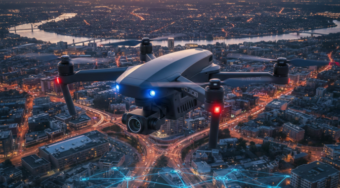
The convergence of autonomous robotics, high-speed cellular networking, and real-time intelligence software has precipitated one of the most significant tactical shifts in the history of municipal policing: the Drone as First Responder (DFR) program. Unlike traditional aviation support, which relies on high-cost, high-altitude rotary-wing aircraft deployed reactively, DFR systems embed unmanned aerial systems (UAS) directly into the fabric of the patrol response. These systems are not merely tools carried in the trunks of patrol cars; they are autonomous or teleoperated assets prepositioned on rooftops, capable of launching immediately upon the receipt of a 911 call and arriving on scene well before ground units can navigate traffic.
This report serves as a comprehensive operational and strategic guide for law enforcement executives, command staff, and policy analysts. It synthesizes data from pioneering agencies—such as the Chula Vista Police Department (CVPD)—and analyzes the emerging regulatory, fiscal, and ethical landscapes defining the future of aerial policing.
Operational Efficacy and Resource Optimization The operational data regarding DFR is compelling. Programs currently active in the United States have demonstrated the ability to place eyes on a scene in under two minutes, frequently beating ground units by substantial margins.1 This “virtual arrival” capability fundamentally alters the information environment for responding officers. Instead of driving blindly into a volatile situation described only by a panicked caller, officers receive real-time, high-definition video feeds that reveal the true nature of the threat. This intelligence allows for the “tactical pause,” a de-escalation strategy where officers can slow their approach, coordinate resources, and avoid the chaotic, rushed entries that often lead to officer-involved shootings.3 Furthermore, mature DFR programs have demonstrated that approximately 25% of calls can be cleared by the drone alone—verifying a call is unfounded or that a subject has left the area—thereby preserving patrol resources for genuine emergencies.2
The Technological Ecosystem The modern DFR program is built upon a complex “system of systems.” It requires the integration of “Drone-in-a-Box” (DiB) hardware that allows for remote charging and protection, advanced avionics capable of Beyond Visual Line of Sight (BVLOS) flight, and sophisticated software stacks that bridge Computer-Aided Dispatch (CAD) systems with real-time video distribution.4 The market is currently bifurcated between cost-effective, high-capability Chinese hardware (DJI) and increasingly mandated American or NDAA-compliant systems (Skydio, Brinc), a shift driven by geopolitical concerns and state-level legislation such as Florida’s SB 92.6
Challenges and Strategic Risks Despite the operational benefits, the path to implementation is fraught with peril. The primary failure mode for DFR programs is not technological but sociological. High-profile cancellations in cities like Seattle, St. Louis, and Bridgeport underscore the volatility of public opinion regarding aerial surveillance.8 Civil liberties organizations, including the ACLU and EFF, have raised significant concerns regarding mission creep, the potential for pervasive suspicionless surveillance, and the psychological impact of a “surveillance society”.10 Furthermore, the regulatory environment remains a bottleneck; while the FAA is moving toward normalizing BVLOS operations through the proposed Part 108 rule, agencies currently must navigate a complex waiver process that requires robust safety cases and often expensive “Detect and Avoid” (DAA) technology.12
Recommendations for Leadership To successfully implement DFR, agency leadership must treat it as a new bureau of policing rather than a simple equipment acquisition. Success requires a “transparency-first” strategy, including public dashboards, strictly defined use policies that prohibit random surveillance, and the decoupling of DFR from immigration enforcement to maintain community trust.8 Financially, agencies must plan for a Total Cost of Ownership (TCO) that leans heavily on software subscriptions and personnel costs, rather than just hardware procurement.14
The era of the patrol car as the sole first responder is ending. The integration of aerial intelligence represents the future of safer, more efficient, and more accountable policing, provided agencies can navigate the complex intersection of technology, law, and public trust.
1. The Strategic Context: The Evolution of Aerial Policing
The history of law enforcement is defined by the tools used to reduce response times and increase situational awareness. In the 1920s, the introduction of the radio-equipped patrol car allowed officers to be dispatched to crimes in progress rather than walking fixed beats. In the 1960s and 70s, the police helicopter introduced the “airborne platform,” offering a perspective that transformed pursuit management and search and rescue. Today, the DFR model represents the third great leap in this evolution, democratizing air support and shifting the paradigm from reactive to proactive intelligence gathering.
1.1 The “Blind Arrival” Gap
The fundamental operational deficiency in modern patrol work is the “Blind Arrival” gap. This is the time delta between the receipt of a 911 call and the arrival of the first officer. During this window—which can range from five to fifteen minutes depending on staffing and traffic—the dispatcher relies solely on the caller’s narrative. Callers are often under extreme duress, unreliable, or intentionally deceptive.
When officers respond to a “man with a gun” call based solely on this fragmented information, they are primed for a high-threat encounter. They may drive at high speeds (Code 3), risking traffic collisions. They approach the scene with weapons drawn and adrenaline spiking. If the reality of the scene is a juvenile with a toy, or a dispute that has already ended, the officer’s heightened physiological state increases the risk of a “mistake-of-fact” shooting or excessive force.
DFR programs close this gap. By launching immediately and traveling “as the crow flies,” the drone arrives within 90 to 120 seconds.2 It acts as a forward scout, relaying objective visual data. If the drone observes that the “gun” is a cell phone, the responding officers receive this intelligence before they even park their cars. The tactical tempo shifts from a frantic rush to a calculated, informed approach. This is the essence of Intelligence-Led Policing applied to the tactical timeline.
1.2 From Trunk Drones to Autonomous Response
The adoption of drones in law enforcement has occurred in three distinct phases, each offering increasing levels of utility and complexity.
Phase 1: The Trunk-Based Model (Visual Line of Sight)
Early adoption (circa 2015-2018) focused on “trunk drones.” These were small consumer quadcopters (like the DJI Phantom) carried by patrol officers or specialized traffic units.
- Mechanism: An officer arrives at a scene (e.g., a fatal crash or a search for a missing hiker), retrieves the drone, sets it up, and flies it.
- Limitation: This model offers zero response time advantage. The drone arrives only when the officer arrives. It provides tactical value for prolonged incidents but fails to address the “Blind Arrival” gap. It is also strictly limited by FAA Part 107 rules requiring the pilot to keep the drone within visual line of sight.1
Phase 2: The Teleoperation Model (BVLOS Waiver)
Pioneered by agencies like Chula Vista PD in 2018, this model centralized the pilot.
- Mechanism: A certified pilot (sworn or civilian) sits in a command center or on a rooftop. The drone is prepositioned on the roof. When a call comes in, the pilot launches the drone remotely.
- Advantage: This introduced the concept of responding ahead of the police car.
- Limitation: It historically required a Visual Observer (VO) on the roof to watch the sky for other aircraft, limiting scalability, although recent “Tactical BVLOS” waivers and DAA technology are removing the need for human VOs.2
Phase 3: The “Drone-in-a-Box” (Autonomous DFR)
The current cutting edge involves fully autonomous docking stations.
- Mechanism: Drones are housed in weather-proof boxes distributed throughout the city (on fire stations, cell towers, or hospitals). They charge automatically and are climate-controlled.
- Advantage: This allows for 24/7 distinct coverage without the need for a human to physically touch the drone. Software integration allows the drone to launch automatically based on CAD triggers, with the teleoperator taking control only for the tactical portion of the flight.4

2. The DFR Operational Architecture
For an agency to implement DFR, it must build a “stack” of technologies that work in concert. It is not enough to buy a drone; the drone must talk to the dispatch system, the pilot must talk to the officers, and the video must flow securely to evidence storage.
2.1 The Hardware Ecosystem: “Drone-in-a-Box” (DiB)
The cornerstone of a modern DFR program is the DiB system—a robotic hangar that facilitates remote operations. The market is currently dominated by two primary competitors, representing a clash between established Chinese manufacturing and emerging American autonomy.4
DJI (Da-Jiang Innovations)
- Hardware: The DJI Dock 2 paired with the Matrice 3D/3DT is the global standard for DFR.
- Capabilities: Known for robust thermal imaging, reliable transmission protocols (O3 Enterprise), and a relatively compact footprint (approx. 34kg for the dock). It supports rapid charging (from 20% to 90% in ~32 minutes).18
- Constraints: The primary liability is political. Federal “Blue UAS” lists and state bans (specifically Florida’s SB 92 and others pending) prohibit many government agencies from purchasing DJI products due to data security concerns regarding the Chinese government.6
Skydio
- Hardware: The Skydio X10 and Skydio Dock represent the leading American alternative.
- Capabilities: Skydio differentiates itself through onboard AI and autonomy. Its obstacle avoidance system is widely considered superior to DJI’s, allowing it to fly confidently near structures or in complex urban canyons with less pilot input.17 The X10 sensor package includes high-resolution thermal and visible light cameras.
- Constraints: Cost is generally higher than DJI equivalents. The ecosystem is closed, and third-party accessory compatibility can be limited compared to the vast DJI aftermarket.17
Alternative Providers
- Fotokite: Provides tethered drone solutions. While not suitable for DFR (which requires mobility), they are often used alongside DFR programs for prolonged static scene overwatch (e.g., structure fires) where battery life is a limiting factor for free-flying drones.4
- Brinc: The Brinc Lemur series is designed for interior tactical clearing (SWAT). While not a DFR drone per se, some agencies integrate them into the trunk of the DFR response vehicle or deploy them once the DFR drone has secured the perimeter.20
The following table compares the two primary DFR hardware ecosystems currently vying for market dominance in law enforcement.
| Feature | DJI Dock 2 (Matrice 3DT) | Skydio Dock (X10) |
| Origin | China | USA (Blue UAS Compliant) |
| Primary Strength | Cost-efficiency, Thermal Quality, Ecosystem | Autonomy, Obstacle Avoidance, NDAA Compliance |
| Charging Time | ~32 Mins (20-90%) | ~40 Mins |
| Ingress Protection | IP55 (Dock) | IP56 (Dock) |
| Regulatory Risk | High (Banned in FL, Federal restrictions) | Low (Preferred for Federal/Grant use) |
| Connectivity | 4G/LTE Dongle optional | 5G/LTE Integrated |
| Obstacle Sensing | Omnidirectional (Standard) | AI-Driven Real-time Mapping (Superior) |
2.2 The Software Stack and Connectivity
The “brain” of the DFR operation is the software that links the 911 call to the propeller spin.
Computer-Aided Dispatch (CAD) Integration
In a mature DFR workflow, the drone system is “listening” to the CAD. When a call is entered with a specific code (e.g., “415F” for Fight, or “Commercial Burglary Alarm”), the software geofences the location.
- Live911: This software has revolutionized DFR by allowing the remote pilot to hear the audio of the incoming 911 call in real-time. Instead of waiting for a dispatcher to type, “Caller reports a man in a red shirt,” the pilot hears the caller say it and can launch immediately. This typically shaves 30-60 seconds off the response time, which is critical in dynamic events.21
Fleet Management and Video Distribution
Once airborne, the video must be distributed.
- Vendors: DroneSense, Axon Air, and Motorola Solutions (CommandCentral) are the leaders. They provide the “cockpit” for the pilot and the “viewing portal” for the officers.
- Latency: The critical metric is latency. For a DFR feed to be tactically useful for officer safety, glass-to-glass latency (from the drone camera to the officer’s phone) must be sub-one second.
- Augmented Reality (AR): Advanced platforms now overlay street names, addresses, and compass headings onto the video feed. This is vital because aerial views can be disorienting; an officer on the ground may not recognize a backyard from above without a digital label.20

3. Tactical Application: Lessons for Officers and Chiefs
The introduction of DFR requires a shift in tactical doctrine. Agencies must rewrite their standard operating procedures (SOPs) to account for the presence of an aerial asset.
3.1 The “Tactical Pause” and De-escalation
The most profound tactical shift enabled by DFR is the “Tactical Pause.” In traditional policing, speed is often equated with safety—get to the scene before it escalates. However, rushing in creates “time compression,” forcing split-second decisions.
With DFR, the drone arrives first. It provides the “stimulus” of eyes-on intelligence. If the drone pilot reports, “Subject is pacing in the driveway, holding a hammer, no one else is near him,” the responding officers can stop their cars a block away. They can formulate a plan, designate a lethal cover officer and a less-lethal officer, and approach using cover. They have bought themselves time.21
In Montgomery County’s program, this capability has been explicitly credited with preventing use-of-force incidents. By verifying that a subject was unarmed or that a reported “gun” was a tool, officers de-escalated their own physiological response before making contact.24
3.2 Perimeter Containment and K9 Operations
In foot pursuits, the drone effectively renders running futile. The DFR asset can orbit at 200-400 feet, keeping the suspect in frame while directing ground units.
- Virtual K9: The drone can clear backyards much faster than a K9 team. In many agencies, the drone is used to “clear the path” for the K9, ensuring the dog and handler do not walk into an ambush.
- Geographical Containment: The pilot can verbally guide officers to “pinch” a suspect: “Unit 1, take the north alley. Unit 2, hold the corner. Suspect is trapped in the middle yard.” This coordination reduces the duration of searches and the disruption to the neighborhood.3
3.3 Traffic and Accident Investigation
While often associated with crime fighting, DFR plays a massive role in traffic management. Drones can quickly assess major traffic accidents, helping supervisors decide whether to call out specialized reconstruction teams or simply tow the vehicles.
- Photogrammetry: Drones can map a fatal crash scene in 15-20 minutes, a process that used to take hours with total stations and laser scanners. This clears the roadway faster, reducing secondary accidents caused by traffic backup.2
3.4 Fire and Rescue Integration
Many DFR programs are joint ventures with Fire Departments. The drone is dispatched to reports of smoke or structure fires.
- Thermal Intelligence: The thermal camera can identify the seat of the fire (the hottest point) before engines arrive, allowing the battalion commander to direct the initial attack lines more effectively.
- Hazmat: In hazardous material spills, the drone can read placards on overturned trucks without exposing firefighters to toxic fumes.25
4. Case Studies and Performance Metrics
Quantifying the value of DFR is critical for justifying the significant taxpayer investment. The data from early adopters provides a roadmap for what agencies can expect.
4.1 The Gold Standard: Chula Vista Police Department (CVPD)
Chula Vista, California, launched its DFR program in 2018 as part of the FAA’s Integration Pilot Program (IPP). It is widely considered the most mature DFR implementation in the world.
- Coverage: CVPD utilizes four launch sites (including the police station, a hospital, and a hotel) to cover 100% of the city’s geography.
- Response Speed: The drones consistently arrive on scene in under 2 minutes. In comparison, Priority 1 ground response times often exceed 5-6 minutes due to traffic.
- Call Clearance: A pivotal metric for CVPD is the “CFS (Call for Service) Avoided” rate. Approximately 25% of all calls attended by a drone are cleared without a ground unit needing to respond. This includes calls like “suspicious person” where the drone finds no one matching the description, or “water leak” reports. This efficiency essentially “creates” more patrol officers by freeing up their time.2
4.2 International Precedents: UK and Dubai
- United Kingdom: The National Police Chiefs’ Council (NPCC) has launched extensive BVLOS trials in Norfolk, Thames Valley, and Hampshire. Unlike the US focus on violent crime, UK trials have heavily emphasized DFR for search and missing persons in rural environments, demonstrating the technology’s flexibility. The UK trials are also testing “detect and avoid” radars to facilitate safer airspace integration.27
- Dubai: The Dubai Police have aggressively adopted DiB technology, integrating it into their “Smart City” initiative. Their program boasts response times as low as 90 seconds in certain districts. Dubai utilizes a unified command center (AirHub) that integrates drone feeds with thousands of static CCTV cameras, creating a level of situational awareness that Western agencies struggle to match due to privacy regulations.22
4.3 Incident Analysis: Where is DFR Used?
Data from Chula Vista reveals that DFR is not primarily a SWAT tool; it is a patrol tool. The most frequent call types are disturbances, domestic violence, and welfare checks—situations with high ambiguity where pre-arrival intelligence is most valuable.

5. The Challenge Landscape: Barriers to Success
While the operational case for DFR is strong, the strategic landscape is mined with obstacles. Failures in Seattle, St. Louis, and Bridgeport demonstrate that ignoring these challenges leads to program cancellation.
5.1 The Regulatory Bottleneck: FAA Part 107 vs. Part 108
For US agencies, the Federal Aviation Administration (FAA) controls the airspace.
- Part 107 (Current Rule): Requires the pilot to see the drone with their own eyes (Visual Line of Sight – VLOS). This makes true DFR impossible without a waiver.
- BVLOS Waivers: To operate DFR, agencies must apply for a Beyond Visual Line of Sight (BVLOS) waiver. Early waivers required a human Visual Observer (VO) on the roof to watch for airplanes.
- “Tactical BVLOS” (TBVLOS): A recent innovation where agencies can fly BVLOS if they stay within close proximity to structures (shielding) or at very low altitudes (below 50 feet above obstacles).
- The Future (Part 108): The industry is awaiting the Part 108 rule, which will standardize BVLOS operations. This rule is expected to mandate certified aircraft and specific pilot training but will eliminate the cumbersome waiver process, likely triggering an explosion in DFR adoption.12
- Detect and Avoid (DAA): Agencies flying true BVLOS over wide areas currently rely on DAA technology—ground-based radar (like DeDrone) or onboard acoustic/optical sensors (like Skydio or Iris Automation) to detect manned aircraft and automatically maneuver out of the way.7
5.2 The “Privacy Kill Switch” and Civil Liberties
Public trust is the single greatest point of failure.
- The “Surveillance Society” Fear: The ACLU and EFF argue that DFR normalizes “persistent surveillance.” They fear that drones deployed for emergencies will eventually be used for routine patrols, predictive policing, or monitoring First Amendment activities (protests).10
- Mission Creep: The ACLU cites examples where drones justified for “life-saving” missions were used for minor nuisance calls like “loud music” or “water leaks,” characterizing this as an expansion of police power without public consent.30
- Failure Case Studies:
- Seattle (2013): One of the first police drone programs was cancelled before it even launched. The mayor ordered the drones returned to the vendor after intense public outcry over the lack of privacy policies.31
- St. Louis (2024): A private attempt to launch a “drone security” service in the city was met with a cease-and-desist order and public protests, highlighting the community’s sensitivity to aerial monitoring, even from non-state actors.32
- Bridgeport, CT (2025): The City Council rejected a contract for autonomous drones due to fears that the data would be shared with federal immigration authorities (ICE) and used for deportation enforcement, illustrating how local policing issues intersect with national political fault lines.8
5.3 Legislative Headwinds: The “Blue UAS” and State Bans
State legislatures are increasingly restricting drone usage.
- Florida (SB 92): This landmark legislation bans Florida government agencies from using drones manufactured in “foreign countries of concern.” This effectively outlawed the use of DJI drones (the market leader) by police in Florida, forcing a costly migration to more expensive American alternatives like Skydio or Teal.6
- California (AB 481): This law classifies drones as “military equipment.” It requires law enforcement to obtain explicit approval from their governing body (City Council) before purchasing drones. This mandates a public forum, a published use policy, and an annual report on how the equipment was used. This ensures transparency but adds a significant administrative burden.35
5.4 Cybersecurity Risks
Drones are flying computers. If not secured, they present vectors for cyberattacks.
- Data Exfiltration: The primary concern driving bans on Chinese drones is the theoretical risk that flight logs, video, or infrastructure data could be sent to foreign servers.
- CISA Guidelines: The Cybersecurity and Infrastructure Security Agency (CISA) recommends “air-gapping” drones (using them without internet connection) for sensitive missions, encrypting all data at rest (SD cards) and in transit (video links), and using secure, complex passwords for all flight accounts.37
6. Implementation and Management: A Roadmap
For a Chief to survive the political and operational challenges, a methodical implementation plan is required.
6.1 Budgeting: The Total Cost of Ownership (TCO)
DFR is capital intensive. Leaders often focus on the drone cost ($10k-$15k) but miss the ecosystem cost.
- Hardware: A “Drone-in-a-Box” station (e.g., DJI Dock 2 or Skydio Dock) costs between $25,000 and $40,000 per unit.
- Software: Fleet management and streaming software (DroneSense, etc.) is typically a recurring subscription (SaaS), costing $30,000 – $60,000 annually depending on fleet size.
- Infrastructure: Installing docks requires power (110v/220v) and hardwired internet drops on rooftops, which can cost thousands in facility upgrades.
- Personnel: This is the largest hidden cost. A DFR program requires a teleoperator on duty. If this is a sworn officer, the cost includes salary plus benefits for 1-2 FTEs per shift.
- Example: The Cincinnati Police Department’s program is estimated to cost $4.8 million through 2033, including 22 drones, radar systems ($250k/year), and software ($450k/year).7

6.2 Staffing Models: Sworn vs. Civilian
Agencies must decide who flies the drone.
- Sworn Officers:
- Pros: Understand tactical language, police codes, and constitutional law (Reasonable Suspicion vs. Probable Cause).
- Cons: Expensive. Removing an officer from the street to sit in a cockpit exacerbates staffing shortages.
- Civilian/Professional Staff:
- Pros: Cost-effective. Easier to recruit from the gaming or tech community. Can be dedicated specialists.
- Cons: Require extensive training on police radio etiquette and legal standards.
- Trend: Many agencies, including Long Beach PD, have moved toward civilianizing their air support units to save costs ($883k savings in Long Beach’s case).39
6.3 Policy and Transparency
To avoid the “Bridgeport Scenario” (cancellation), transparency is non-negotiable.
- Dashboard: Implement a public-facing dashboard (like Chula Vista’s) that shows flight paths, call types, and launch locations in near real-time (often with a short delay for officer safety).
- Policy Constraints: Write policies that explicitly forbid:
- Surveillance of First Amendment assemblies (protests) without a warrant or specific threat.
- Facial recognition usage on drone video (unless strictly regulated).
- Weapons attachment (lethal or non-lethal).
- Community Engagement: Before buying the first drone, hold town halls. Bring the drone to community events. Let the public see the “view from above” to demystify the technology.40
6.4 The IACP Roadmap
The International Association of Chiefs of Police (IACP) and other bodies recommend a “Crawl, Walk, Run” approach:
- Crawl: Start with visual line of sight operations for major accidents and search and rescue. Build a track record of safety and success.
- Walk: Apply for BVLOS waivers. Implement a “Daylight Only” DFR program in one specific precinct. Gather data on response times and clearance rates.
- Run: Expand to city-wide 24/7 autonomous coverage using DiB technology and civilian pilots. Integrate with RTCC and ShotSpotter.3
Conclusion
The “Drone as First Responder” model is not merely a technological upgrade; it is a fundamental restructuring of police response. It offers the promise of a safer, more efficient, and more informed police force. However, this potential can only be realized if the technology is implemented with a keen sensitivity to the “Social Contract.”
The drone must be viewed by the community as a life-saving tool, not an eye in the sky. For the Chief, the mission is to balance the capability of the machine with the trust of the public. If that balance is maintained, the DFR program will likely become as indispensable to 21st-century policing as the radio was to the 20th.

Works cited
- Drones as First Responders – CNA Corporation, accessed January 25, 2026, https://www.cna.org/reports/2025/09/Drones-as-First-Responders.pdf
- chula vista police department – drone as first responder (dfr) – Microsoft Power BI, accessed January 25, 2026, https://app.powerbigov.us/view?r=eyJrIjoiNWNiYmI5ZTEtMzVjZi00NjNjLTkzNzgtNjg5NDQ3Yzk1NzEzIiwidCI6IjU2ZmM0NjE4LWM4M2QtNDAxZS1hNTMxLWZlYTEyNGI2NDZhNyJ9
- All the Buzz About Drones as First Responders – Police Chief Magazine, accessed January 25, 2026, https://www.policechiefmagazine.org/all-the-buzz-dfr/
- CITYAM empowers responsible urban air mobility – Interreg Baltic Sea Region, accessed January 25, 2026, https://interreg-baltic.eu/wp-content/uploads/2024/01/D.1.3.-The-path-towards-the-use-cases-landing-sites-and-plan-of-implementation.pdf
- Drone as First Responder (DFR) – Advexure, accessed January 25, 2026, https://advexure.com/pages/drone-as-first-responder-dfr
- Drones – Is This the Future of Law Enforcement? – FDLE, accessed January 25, 2026, https://www.fdle.state.fl.us/getContentAsset/402e3e5e-0e68-4a43-b11d-36e86ce43880/73aabf56-e6e5-4330-95a3-5f2a270a1d2b/Mahla-Dan-paper.pdf?language=en
- Cincinnati Police Skydio Drone Program Costs Revealed – DroneXL, accessed January 25, 2026, https://dronexl.co/2025/11/30/cincinnati-pd-skydio-drone-program-costs/
- Bridgeport police drone plan not cleared for take off, for now – Connecticut Public Radio, accessed January 25, 2026, https://www.ctpublic.org/news/2026-01-21/bridgeport-police-drone-plan-not-cleared-for-take-off-for-now
- Seattle Mayor Nixes Drone Program – Government Technology, accessed January 25, 2026, https://www.govtech.com/security/seattle-mayor-nixes-drone-program.html
- Eye-in-the-Sky Policing Needs Strict Limits – ACLU, accessed January 25, 2026, https://www.aclu.org/wp-content/uploads/2023/07/embargo-drones-as-first-responder-programs-final-electronic.pdf
- In a Major Privacy Victory, Seattle Mayor Orders Police to Dismantle Its Drone Program After Protests | Electronic Frontier Foundation, accessed January 25, 2026, https://www.eff.org/deeplinks/2013/02/major-privacy-victory-seattle-mayor-orders-police-not-use-surveillance-drones
- Normalizing Unmanned Aircraft Systems Beyond Visual Line of Sight Operations, accessed January 25, 2026, https://www.federalregister.gov/documents/2025/08/07/2025-14992/normalizing-unmanned-aircraft-systems-beyond-visual-line-of-sight-operations
- FAA Releases Long-Awaited BVLOS Proposed Rule, accessed January 25, 2026, https://www.pillsburylaw.com/en/news-and-insights/faa-proposed-rule-bvlos.html
- What does a Drone as First Responder program really cost? – Police1, accessed January 25, 2026, https://www.police1.com/drones/what-does-a-drone-as-first-responder-program-really-cost
- FAA Has Made Progress in Advancing BVLOS Drone Operations but Can Do More To Achieve Program Goals and Improve Data Analysis – DOT OIG, accessed January 25, 2026, https://www.oig.dot.gov/sites/default/files/library-items/FAA%20BVLOS%20Drone%20Operations%20Final%20Report_6.30.2025.pdf
- Drone as First Responder Programs: 2025 in Review | Electronic Frontier Foundation, accessed January 25, 2026, https://www.eff.org/deeplinks/2025/12/drone-first-responder-programs-2025-review
- Drones: Skydio vs DJI – American Ingenuity vs International Excellence, accessed January 25, 2026, https://p1drones.com/2023/10/04/drones-skydio-vs-dji-american-ingenuity-vs-international-excellence/
- Comparison between DJI dock, Skydio dock lite, and HEISHA D50 drone dock, accessed January 25, 2026, https://heishatech.com/comparison-between-dji-dock-skydio-dock-lite-and-heisha-d50-drone-dock/
- Hey Skydio how much does the X10 cost? – Reddit, accessed January 25, 2026, https://www.reddit.com/r/Skydio/comments/16o0au0/hey_skydio_how_much_does_the_x10_cost/
- BRINC x Motorola Solutions: A Game-Changer for Public Safety, accessed January 25, 2026, https://brincdrones.com/news/brinc-x-motorola-solutions-a-game-changer-for-public-safety/
- Drone Program | City of Chula Vista, accessed January 25, 2026, https://www.chulavistaca.gov/departments/police-department/programs/uas-drone-program
- How Dubai Police Uses AirHub for Drone as First Responder, accessed January 25, 2026, https://www.airhub.app/resources/how-dubai-police-uses-airhub-for-dfr
- Guide: Key considerations for Drone as First Responder Program – Skydio, accessed January 25, 2026, https://www.skydio.com/resources/guides/guide-key-considerations-for-a-drone-as-first-responder-program
- DFR in action: Inside Montgomery County PD’s Drone as First Responder program – Police1, accessed January 25, 2026, https://www.police1.com/drones/dfr-in-action-inside-montgomery-county-pds-drone-as-first-responder-program
- The Evolving Role of Drones in Public Safety: Lessons from the Front Lines | UVA SCPS, accessed January 25, 2026, https://www.scps.virginia.edu/center-public-safety-and-justice/news/evolving-role-drones-public-safety-lessons-front-lines
- AirWorks 2020: Drone as a First Responder by Chula Vista PD – Insights – DJI, accessed January 25, 2026, https://enterprise-insights.dji.com/blog/dji-airworks-2020-breakouts-drone-as-a-first-responder
- Use of drones in policing, accessed January 25, 2026, https://www.npcc.police.uk/our-work/work-of-npcc-committees/operations-coordination-committee/police-use-of-drones/
- First trial of innovative police drone technology, accessed January 25, 2026, https://news.npcc.police.uk/releases/innovative-police-drone-technology-trialled-at-isle-of-wight-festival
- Drone as First Responder explained – YouTube, accessed January 25, 2026, https://www.youtube.com/watch?v=jy1_fNG6Zac
- Eye-in-the-Sky Policing Needs Strict Limits | American Civil Liberties …, accessed January 25, 2026, https://www.aclu.org/documents/eye-in-the-sky-policing-needs-strict-limits
- Seattle PD grounds drones after protests – Police1, accessed January 25, 2026, https://www.police1.com/police-products/police-drones/articles/seattle-pd-grounds-drones-after-protests-f8dodgpYcecQLdxF/
- Out of state drone company plans to fly over St. Louis Monday, despite cease-and-desist letter fr… – YouTube, accessed January 25, 2026, https://www.youtube.com/watch?v=IJ6yeLKews4
- St. Louis Leaders Push Back Against Surveillance Drones – GovTech, accessed January 25, 2026, https://www.govtech.com/products/st-louis-leaders-push-back-against-surveillance-drones
- Chapter 934 Section 50 – 2023 Florida Statutes – The Florida Senate, accessed January 25, 2026, https://www.flsenate.gov/laws/statutes/2023/934.50
- Assembly Bill 481 – Military Equipment Funding, Acquisition & Use Policy | Los Altos, CA, accessed January 25, 2026, https://www.losaltosca.gov/396/Assembly-Bill-481—Military-Equipment-F
- San Francisco Police Break State Law, Illegally Acquire Surveillance Drones, accessed January 25, 2026, https://afsc.org/newsroom/san-francisco-police-break-state-law-illegally-acquire-surveillance-drones
- DRONES, CYBER SECURITY AND CRITICAL INFRASTRUCTURE, accessed January 25, 2026, https://cybersecuritycrc.org.au/remote-assets/sites/default/files/2024-05/Flight%20Critical.pdf
- Cybersecurity Best Practices for Operating Commercial Unmanned Aircraft Systems (UASs) – CISA, accessed January 25, 2026, https://www.cisa.gov/sites/default/files/publications/CISA%20Cybersecurity%20Best%20Practices%20for%20Operating%20Commerical%20UAS%20%28508%29.pdf
- Review and Status Update on Restructuring the Air Support Unit – Memorandum, accessed January 25, 2026, https://www.longbeach.gov/globalassets/city-manager/media-library/documents/memos-to-the-mayor-tabbed-file-list-folders/2021/july-16–2021—review-and-status-update-on-restructuring-the-air-support-unit
- The Top 6 Reasons Police UAV Programs Fail – DARTdrones, accessed January 25, 2026, https://www.dartdrones.com/blog/top-police-uav-fails/
- The Truth about Drones, accessed January 25, 2026, https://droneanalyst.com/wp-content/uploads/2016/12/TheTruthAboutDrones_safety.pdf